Saturday, April 24, 2010

The Inca Trail

Since leaving the harsh roads of southern Bolivia behind, I´ve been on the trail of South America´s most famous historical dynasty - the Incas. The trail is well worn and firmly on the beaten track. But that just means most of the enticing ruins are connected by smooth tarmac roads instead of bone rattling washboard (a welcome change if you ask me).

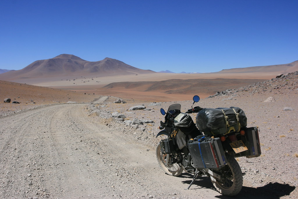
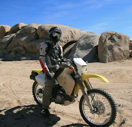
Picking up the trail
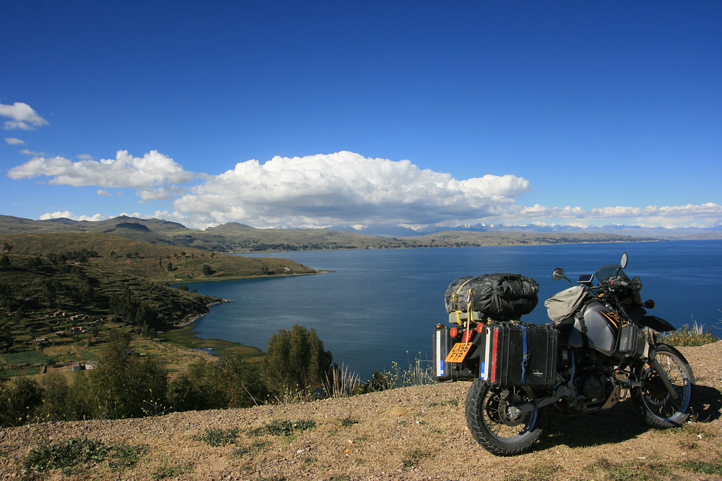
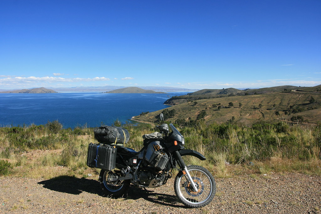
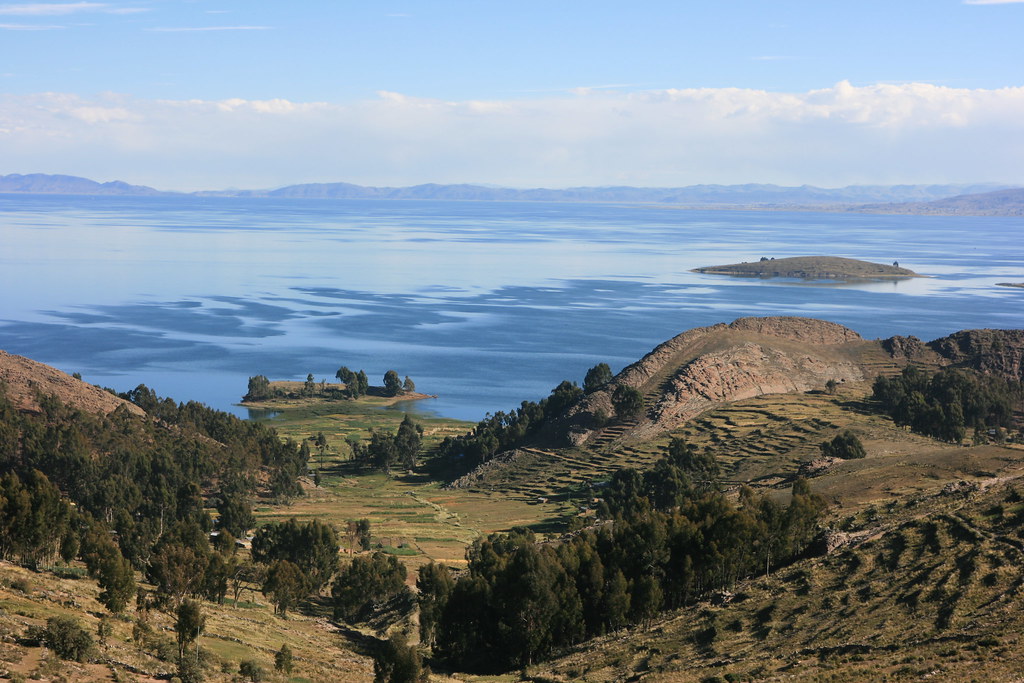
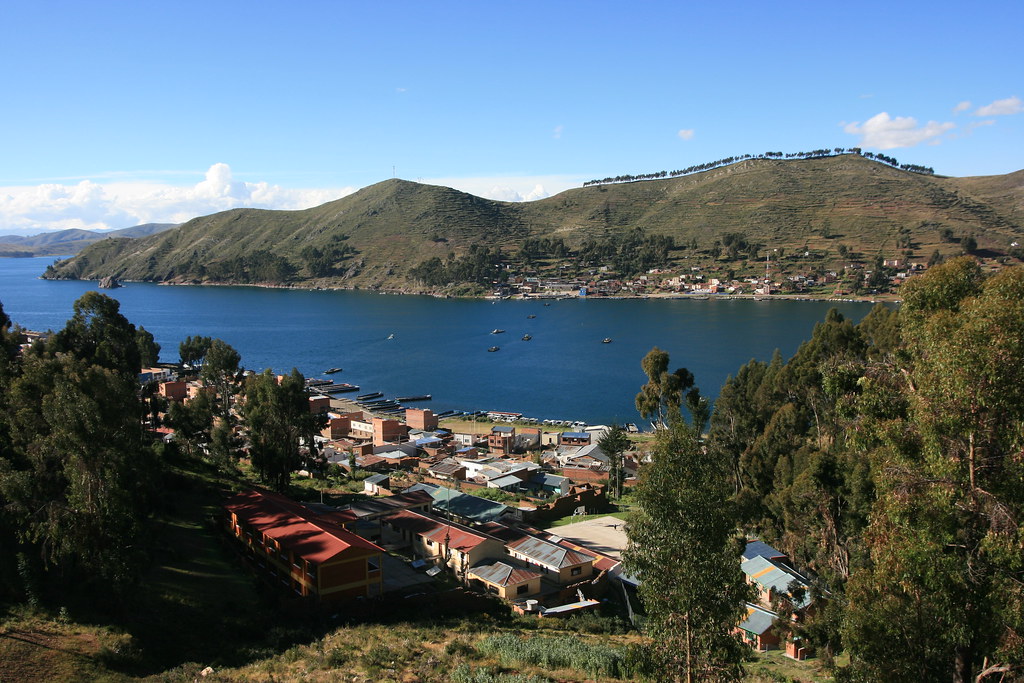
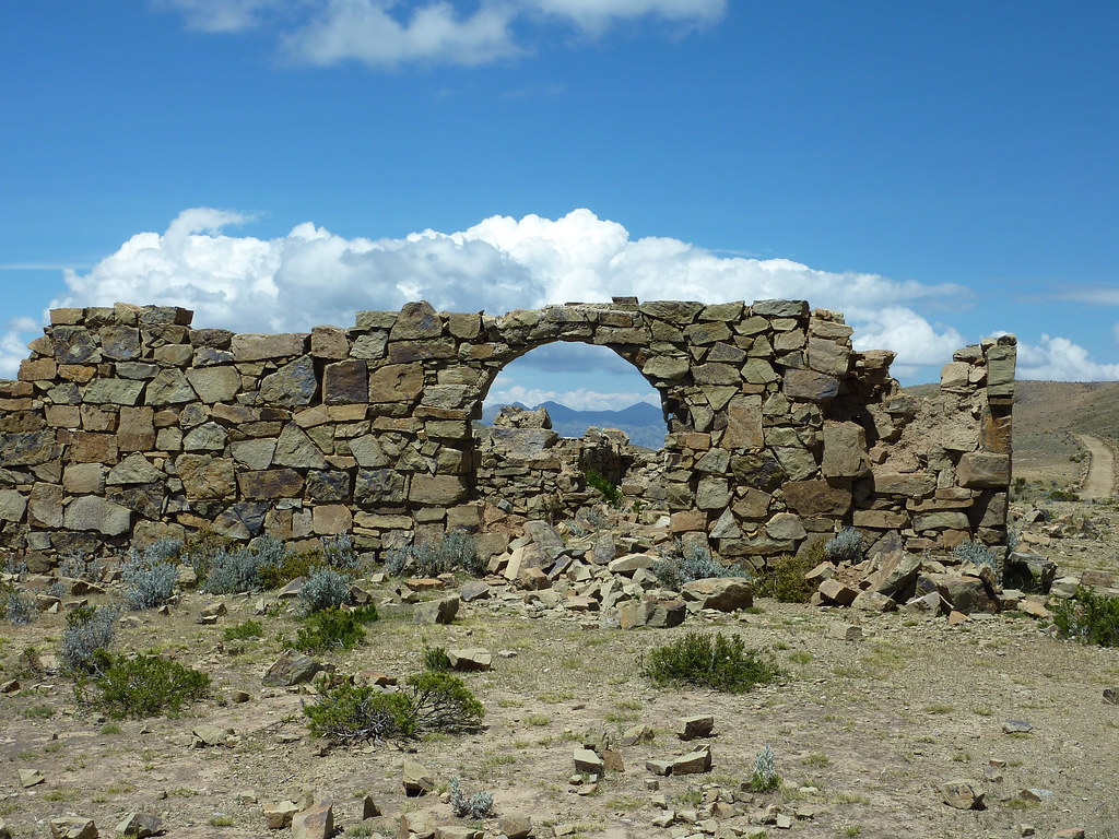
It´s impossible to travel through South America without encountering the legacy of the Inca Empire. At its peak, some six or seven centuries ago, the Empire stretched from northern Argentina to the Equator. Modern day Peru was at its heart, but according to some myths, the Inca dynasty actually began in Bolivia on the Isla del Sol - just off the eastern shore of Lake Titicaca. And that´s where I first picked up the Inca trail.

In constrast to southern Bolivia where paved roads are still something of a futurisitc phenomenon, the Isla del Sol and the area surrounding Lake Titicaca are reached by some of the smoothest and most picturesque roads on the continent.


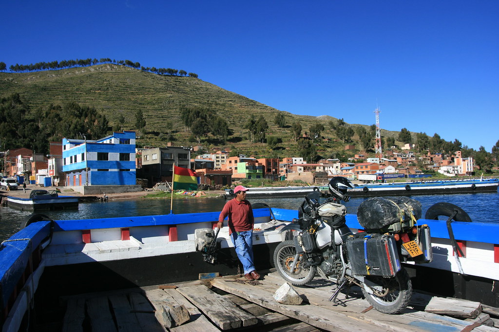
Nestled on the shore of the Lake is the small town of Copacabana which, unlike the famous beach in Brazil or nightclub in Florida, doesn´t have any showgirls named Lola (or any showgirls at all come to think of it). But even without the showgirls it´s still a lively little burg and is the main jumping off point for boat trips into the lake.


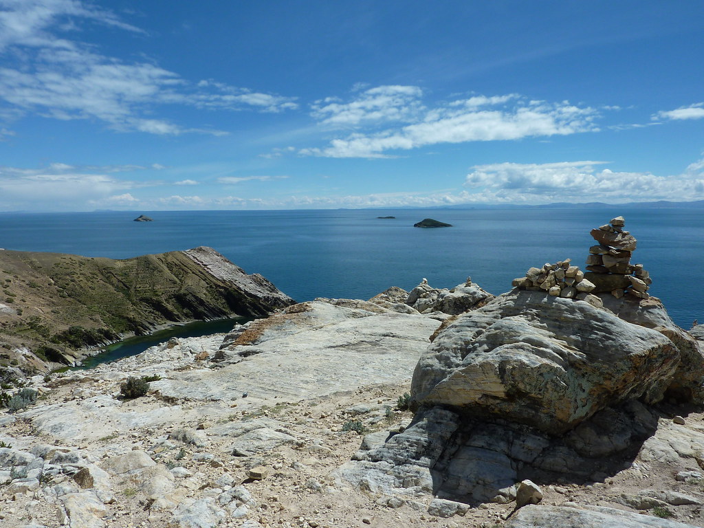
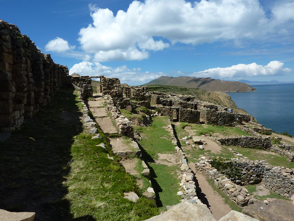
On the day I visited the island, the Inca Sun God (Inti) was obviously feeling jolly good about himself as it was a glorious sunny day. Needless to say, after visiting the sacred rock, a few ruins, and hiking five miles along the spine of the island, Inti had made his mark on me too, turning my pasty skin to a lobster pink - dashing.


Back on the road and covered in aloe vera, I circled the southern shore of the Lake, crossed into Peru, and turned inland toward the hub of the Inca Empire - Cusco.


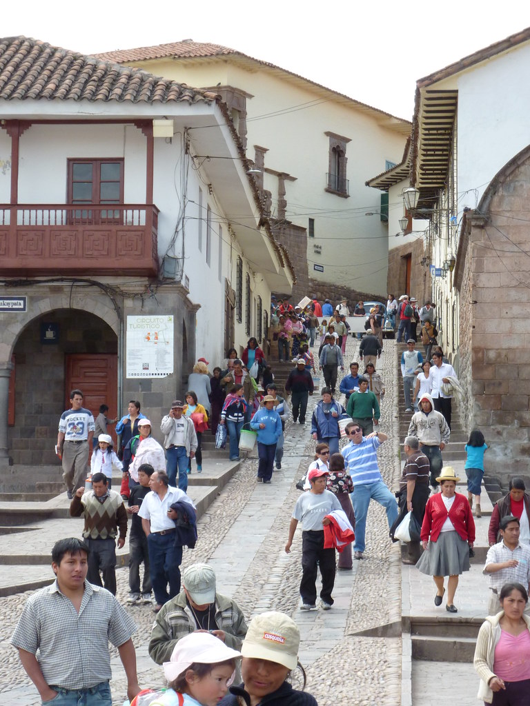
Cusco is a busy, vibrant city with Inca ruins quite literally all over the place. The ruins are so abundant that many of the hotels boast of having "Inca walls" in their paraphenalia.

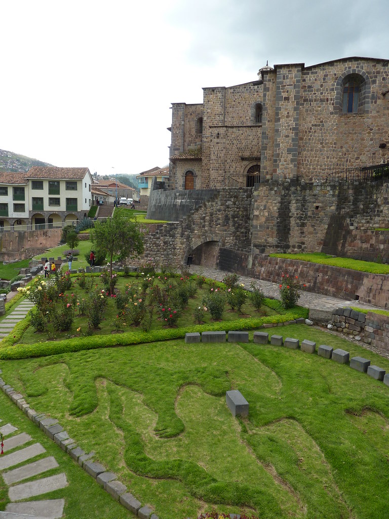
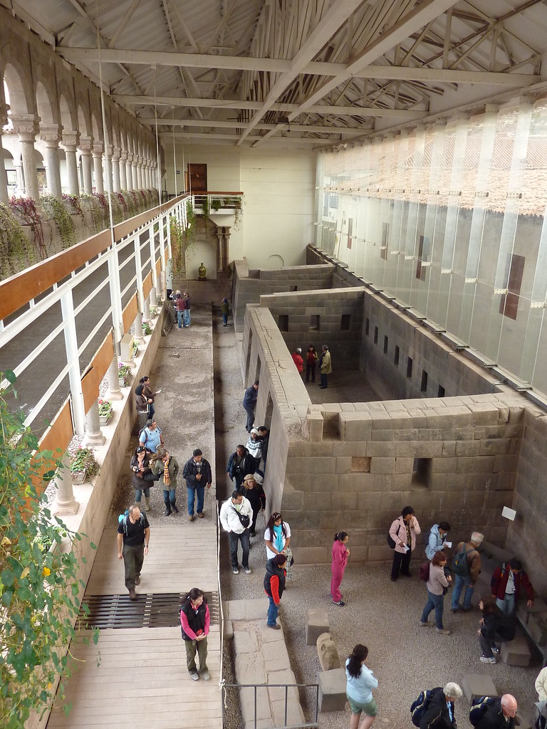
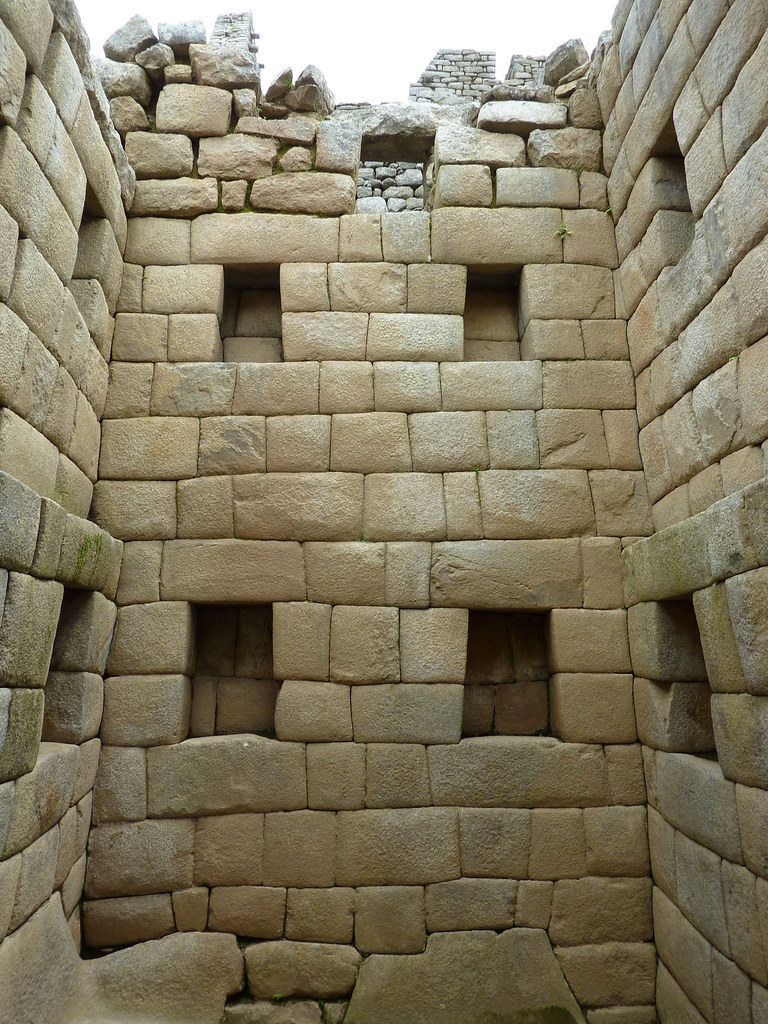
But perhaps the best sight in Cusco, as hotly tipped by Jerry - the Indiana Jones of our riding group - is the Sun Temple. The key thing about this temple is not the immaculate stonework that has withstood earthquakes and several hundred years of abuse. The most interesting thing about the temple is it is buried beneath a church. The Spanish Conquistadors were so keen to convert the natives to Christianity they decided to build their own place of worship right on top of the Inca temple - stick that in your Inca pipe and smoke it.


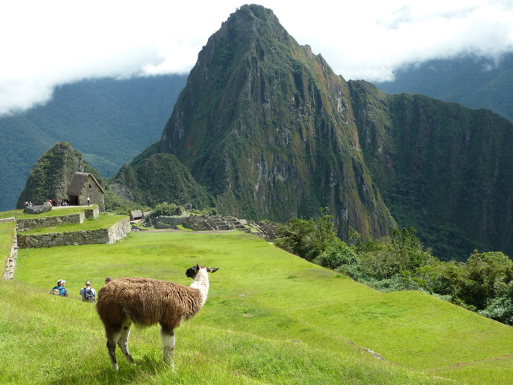
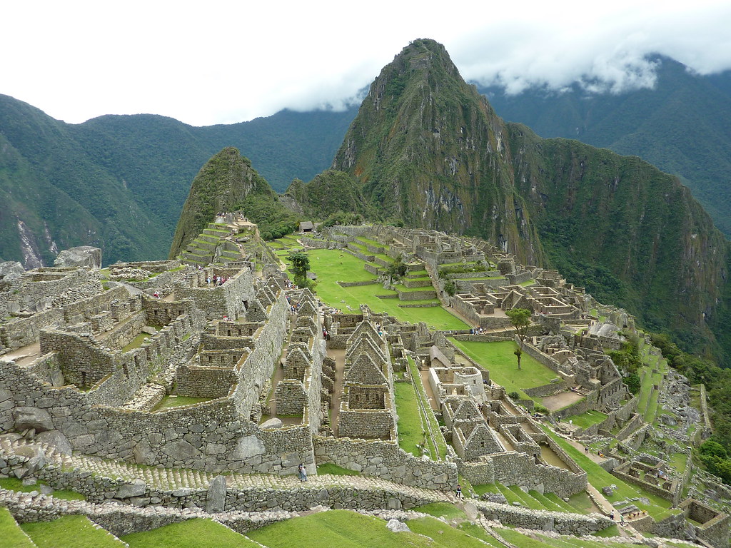
But obviously the top Inca sight on most people´s lists is the world-renowned mountain-top citadel of Machu Picchu.

Normally, the high altitude ruins are reached via an expensive tourist train or via the popular hiking trail. But mudslides earlier in the year washed away the tracks and made the trail all but impassable. After hasty repairs, both routes re-opened on April 1st, but with a backlog of tourists to get through, both the train and the trail were fully booked by the time I showed up. Fortunately though, I managed to find a lesser-known ´back way´ into Machu Picchu which even involved a bit of biking.

The back way into Machu Picchu
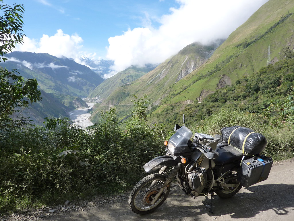
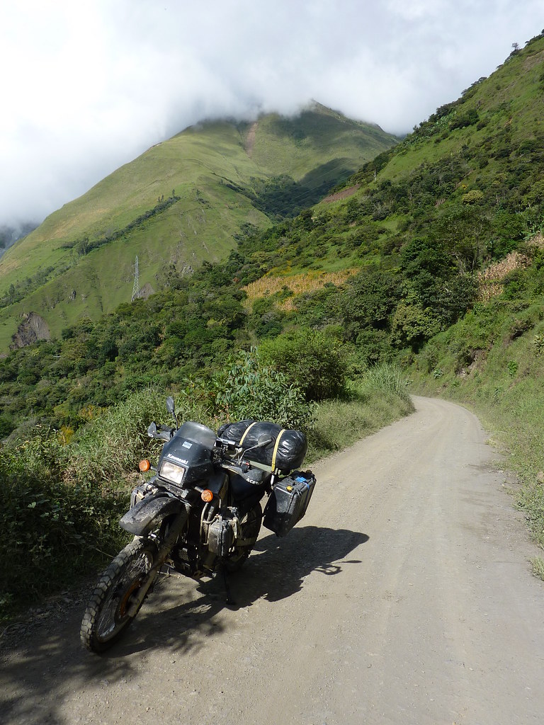
Instead of taking the train west from Cusco toward Machu Picchu, I headed north via a glorious paved road into an adjacent valley. The road wound its way up into the mountains via a series of hairpins, each guarded by a solitary wild dog. How those pooches got up there and what they were doing I honestly don´t know, but there were so many lonely pups that I half expected to see a satisfied looking Boddingtons surrounded by his bitches at the top. No such luck.

After riding past the dogs and through the clouds I began my descent into the valley below. Clearly the mudslides that wiped out the routes to Machu Picchu were not a one off - I frequently came across landslides, boulders and waterfalls flowing across the road.


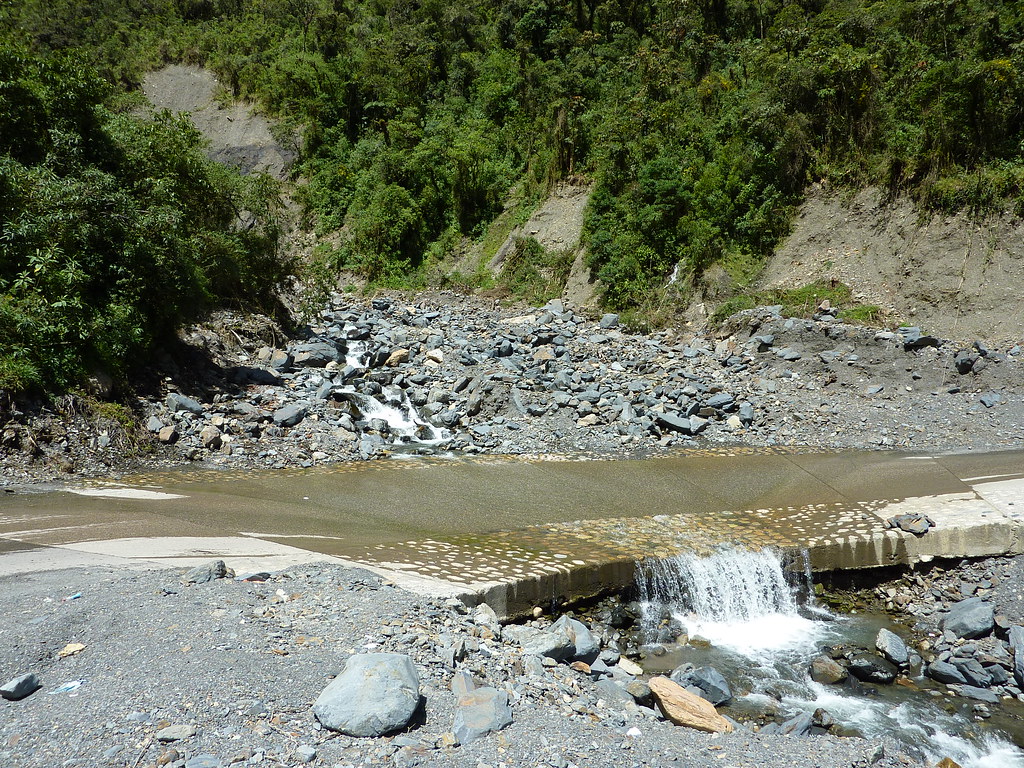
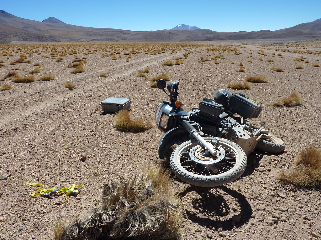
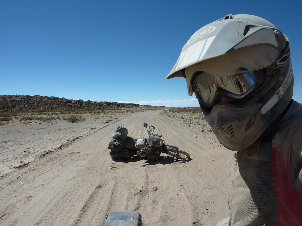
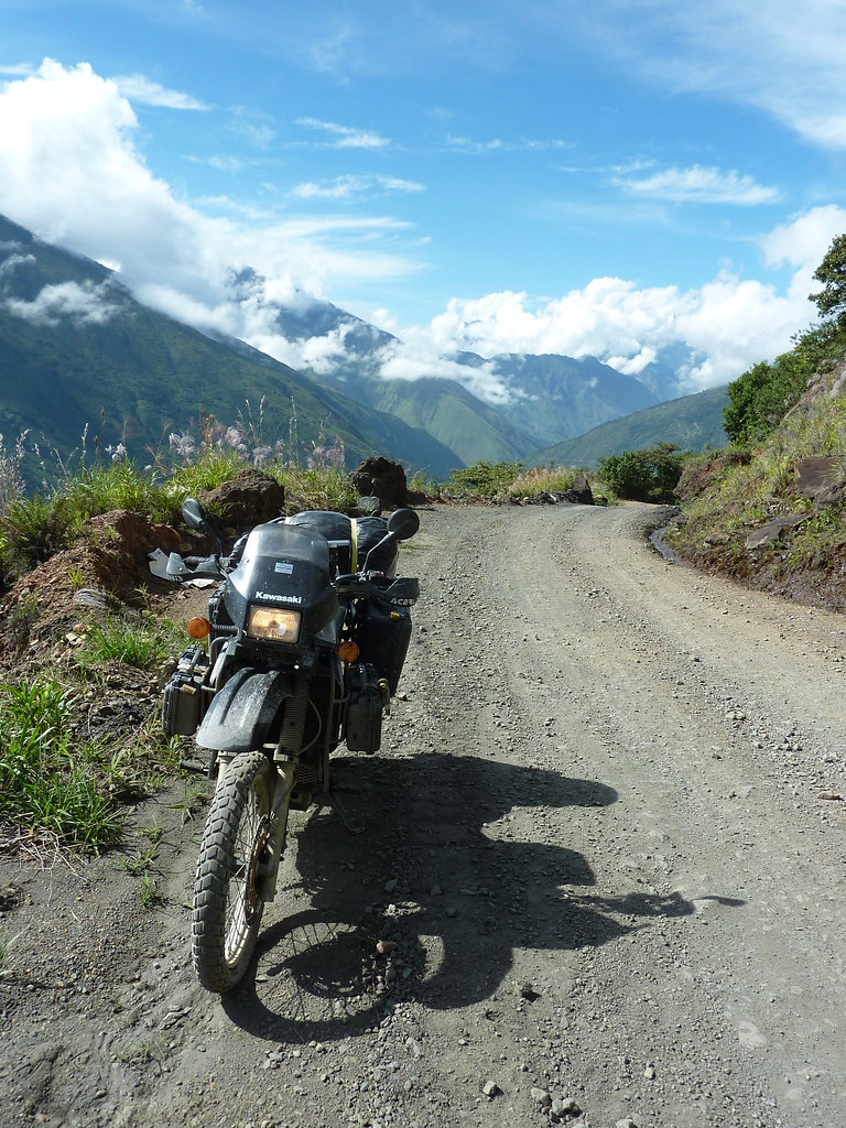
But the going was good for the first 60 miles. After that, the smooth pavement gave way to a rough corrugated road which came complete with slow, dust spewing trucks. But that degradation was only Stage 2 of the ride. Stage 3 - some 20 miles further on - saw the wide corrugated road turn into a narrow muddy track that wound its way steeply up into the mountains. This was Jerry country all right - on the trail of some lost civilisation riding in the mud - he would have been in Hog´s Heaven. As for me, I squirmed my way through, narrowly avoiding being washed down the mountain in a deceptively deep waterfall crossing.


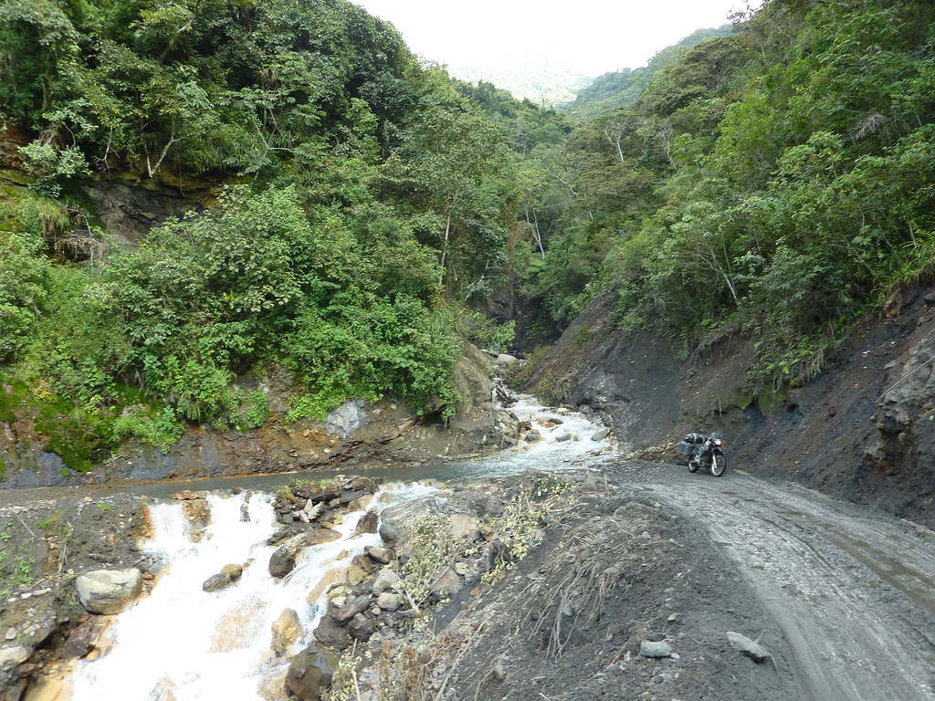
The tricky terrain was more than worth it though just to ride through the lush mountain scenery. And by dusk I´d reached Santa Theresa - as far as my bike could take me.


It was a satisfying day and I was pleased that I´d gotten off the beaten track and travelled a fairly unique route. At least I thought it was unique. But my dreams of originality were quoshed on finding a tourist hotel in Santa Theresa. There, I was not only greeted by a friendly German chap (Michael) who had ridden the exact same path two days before, but also a big group of hikers who were doing a similar thing on foot. Ah well, the company was good at any rate.

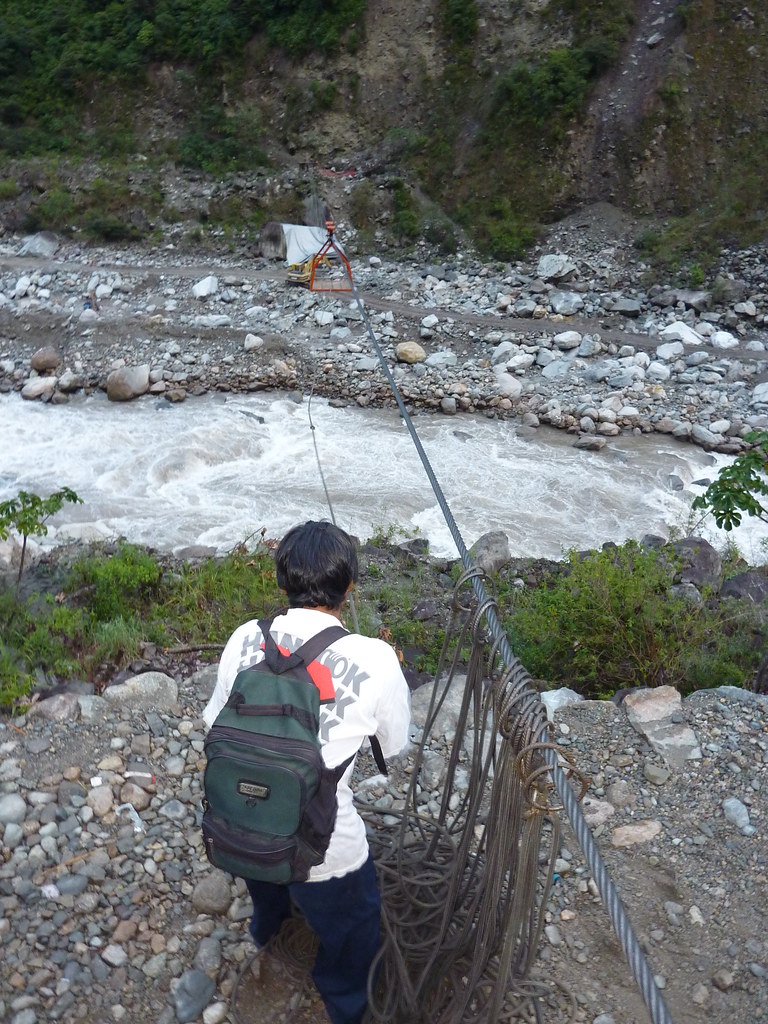
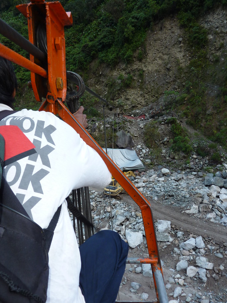
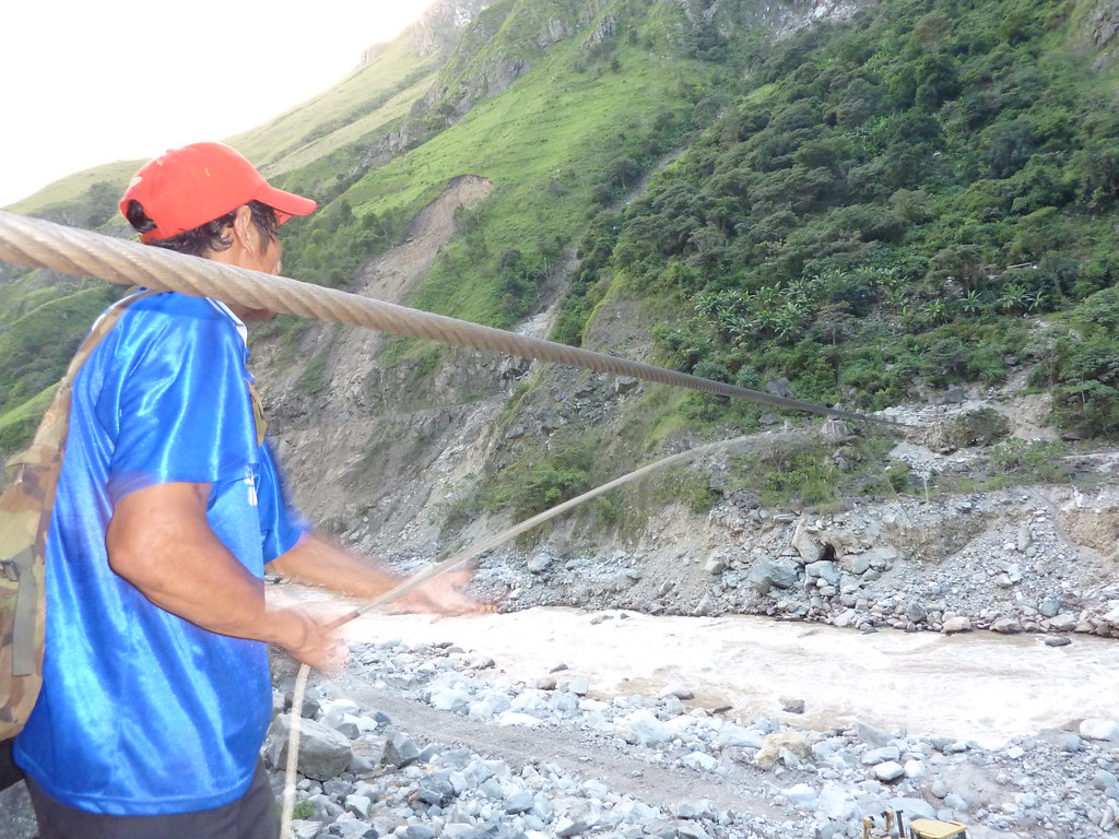
Up at dawn the next day I found out why I couldn´t ride my bike all the way to Machu Picchu - there was no bridge across the Villabamba River. Instead, the only way across was via a high wire cable and small metal basket. The locals seemed to trust the precarious looking contraption, and so with Alex the farmer in front of me, I hopped in the basket and got pulled across. Marvellous.


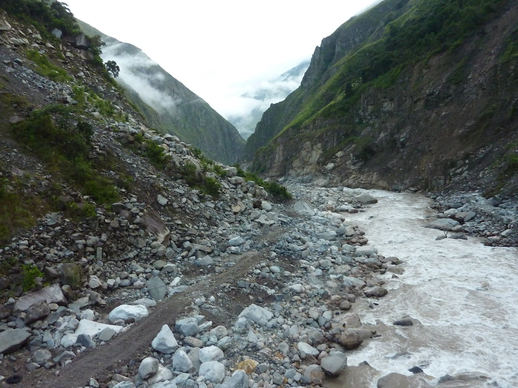
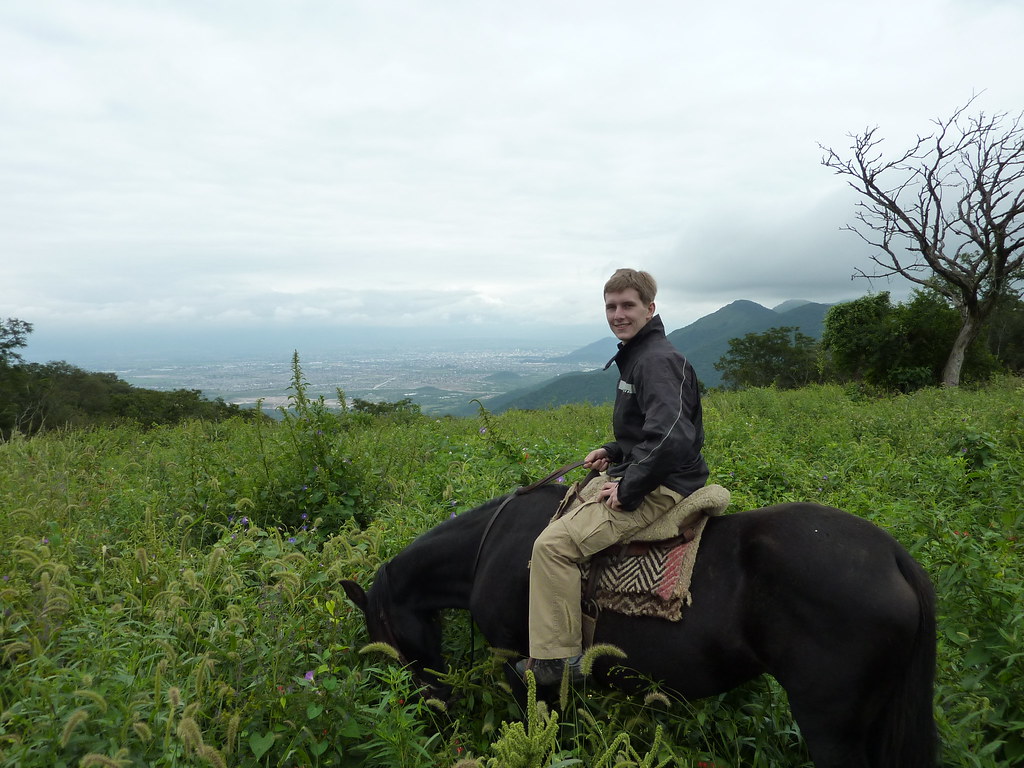
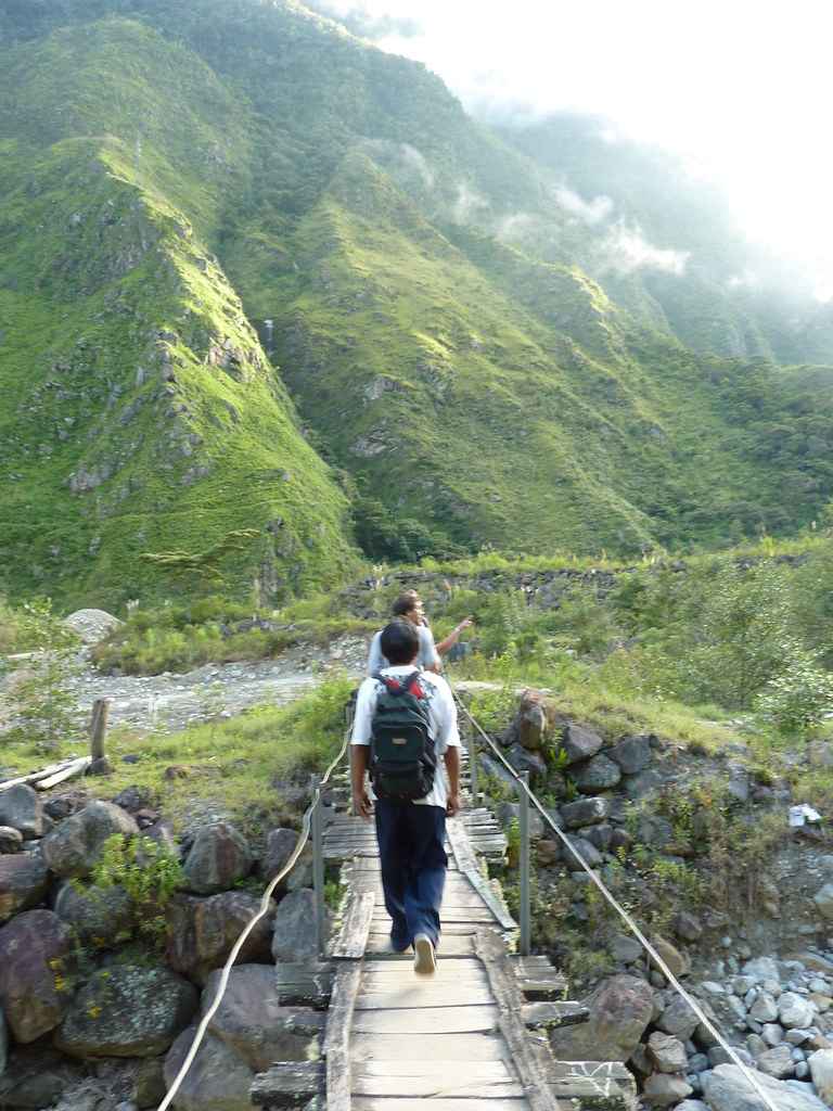
On the other side, Alex and I began the long hike to Machu Picchu. Ten miles of trudging over streams and along the railway tracks. Beautifully picturesque but tiring - I found it hard to believe that Alex made the journey everyday.


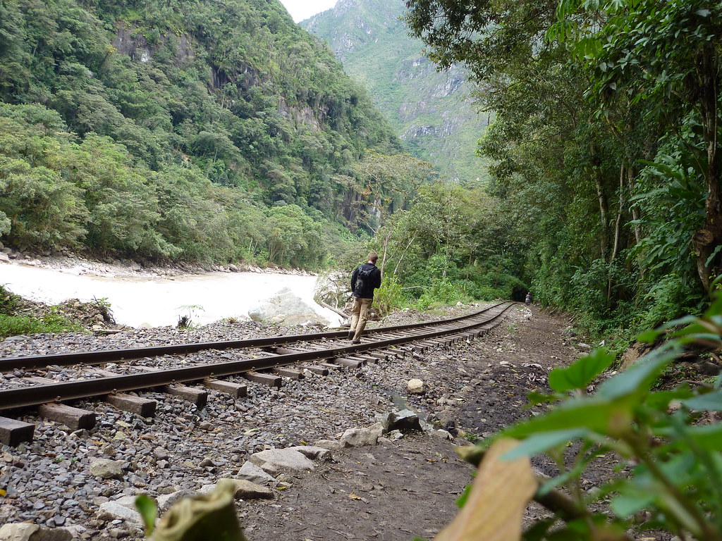
By nine o´clock we had reached Aguas Calientes - tourist base for Machu Picchu. There I bid farewell to Alex who wandered off for several hours of hard labour in the fields, while I got carted up to the famous ruins with a bus load of other tourists.

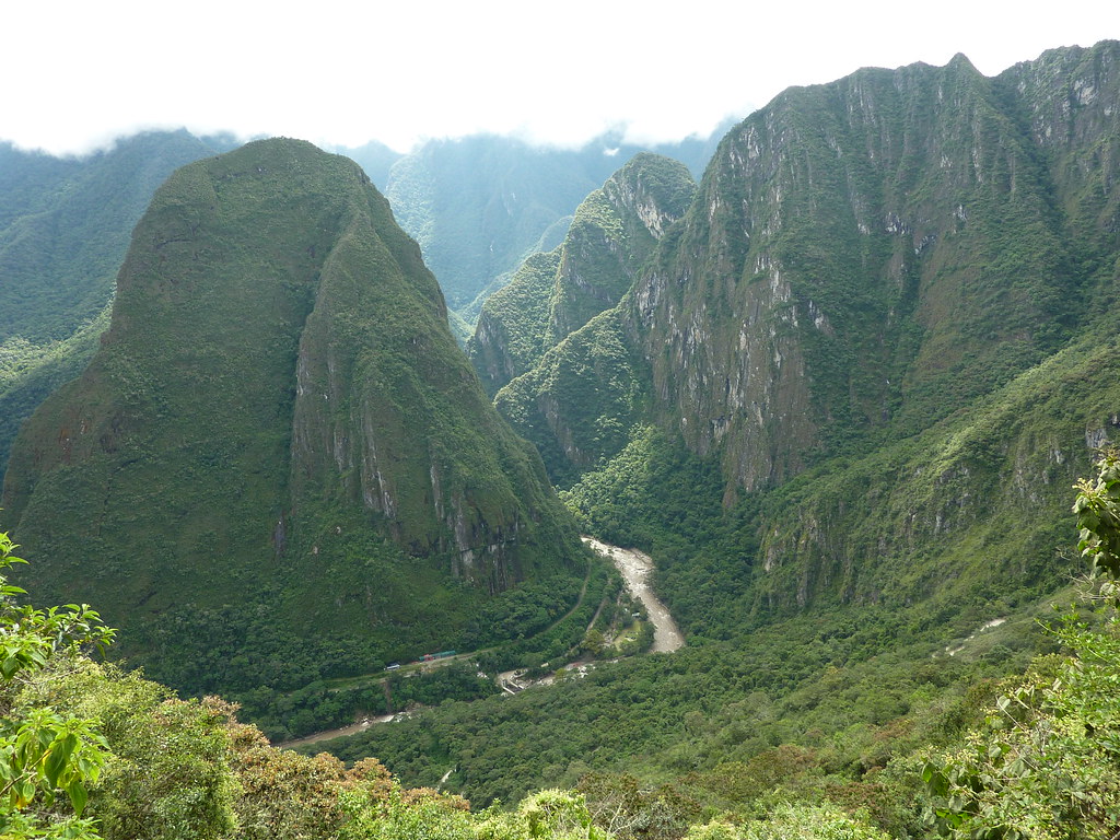
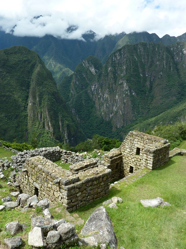
The views from the top were unforgettable. Granite spires towering up towards the clouds like skyscrapers, covered in thick jungle, with the churning torrent of the river below. And in the midst of all the natural beauty, high up in the trees, were the ruins. Extensive, ornate and amazingly intact thanks to the archaic but effective earthquake proof-niches built into the walls. Sun temples, agricultural terraces, barns, homes and more. Justifiably a city. A city in the clouds. A city with a view. Those clever Incas.


End of the Trail
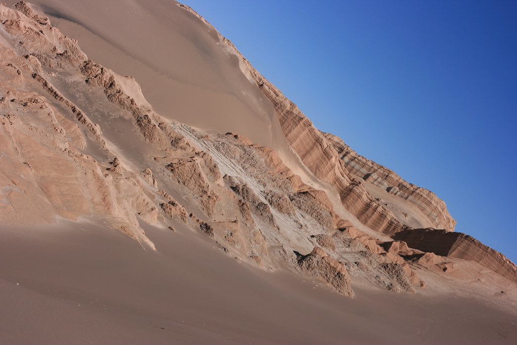
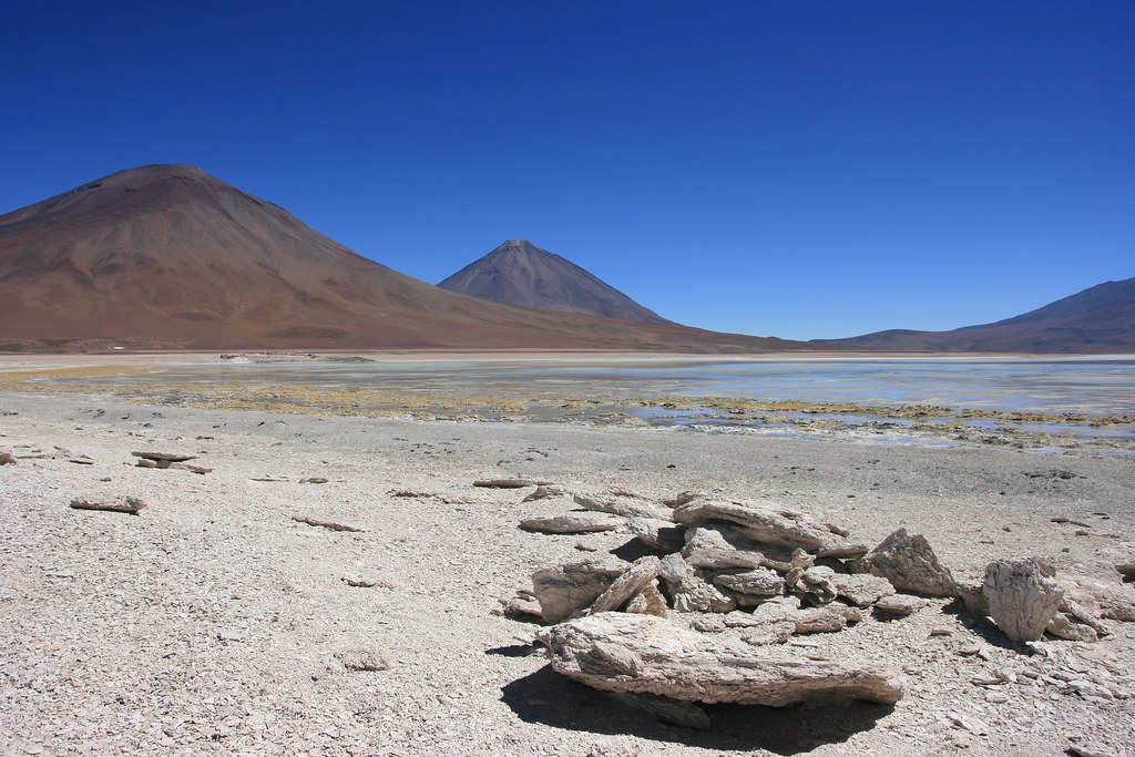
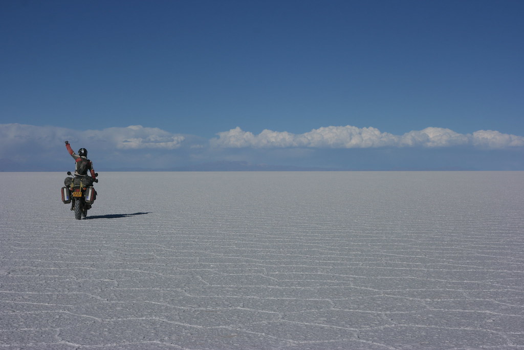
With the majestic mountain ruins behind me, there was still one more Inca sight on my list of things to see - the mysterious Nazca lines of the coast. Reached by one of Peru´s great roads, I expected the going to be easy and scenic. Scenic it was, easy it was not. At 4000m above sea level, I was anticipating the final high altitude pass of the trip to be a bit chilly. Instead I was battered with freezing rain, marble sized hailstones and snow. Snow in Peru - would you believe it! I thought the Salar de Uyuni would be the closest I´d get to riding my bike in the white stuff - how wrong I was.


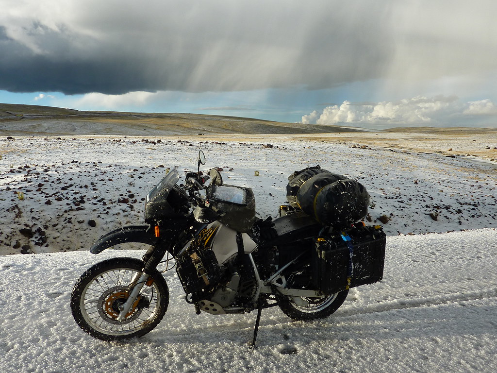
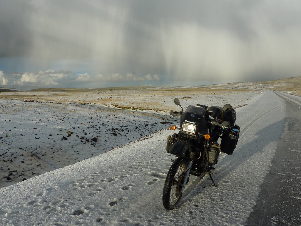
I shuddered my way down the mountain, descending into the merciful warmth of the desert. There, etched into the coastal plains, were the Nazca lines - giant complex murals like ancient crop circles in the rock. One in the shape of a monkey, another a frog, a shepherd, a tree, a llama. Some people have devoted their lives to discovering the meaning of these lines but their origin is still disputed. Probably the most accepted theory is they represent some sort of vast astronomical Inca calendar. Interestingly, the Incas didn´t use the stars to form their astronomical constellations but used the darker bits or "black clouds" of the Milky Way.


The shapes of the lines and the shapes of their black cloud constellations certainly seems to match up. So maybe the theory does hold water. But it seems a bit of an unnecessary effort to build such a large calendar in the desert. Who would read it? Personally, based on my own five minutes of study, I think the vast shapes represent ornate racing tracks for Guinea Pigs - the Inca equivalent of scaletrix. Only time will tell who is right.

End of the Road
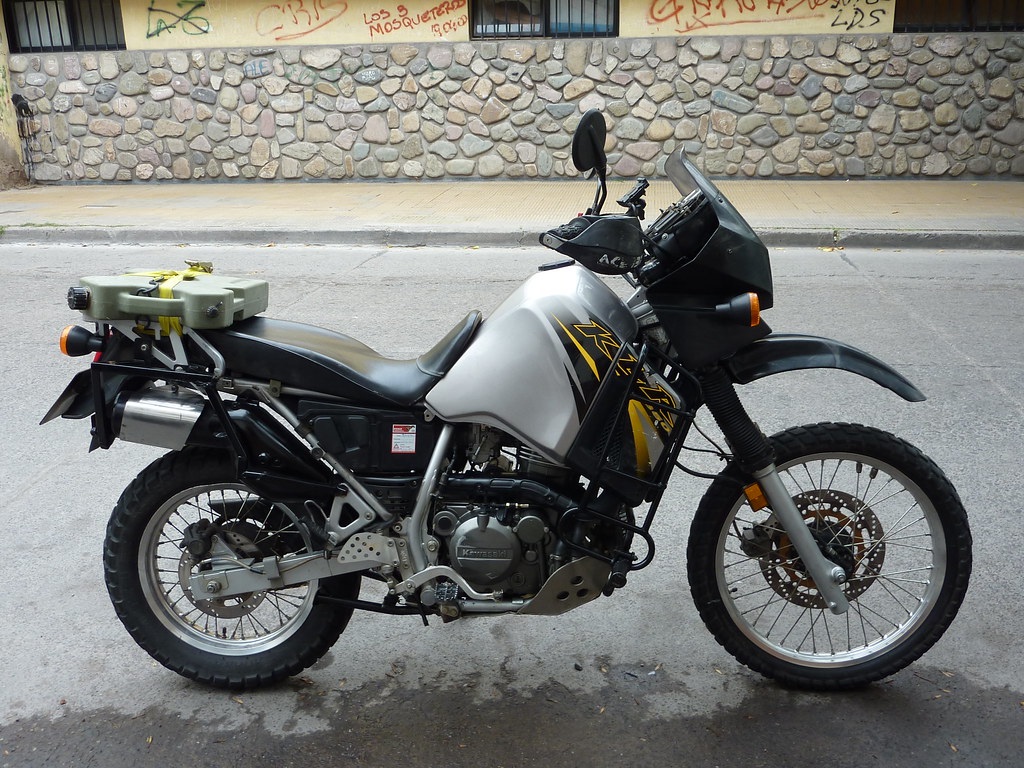
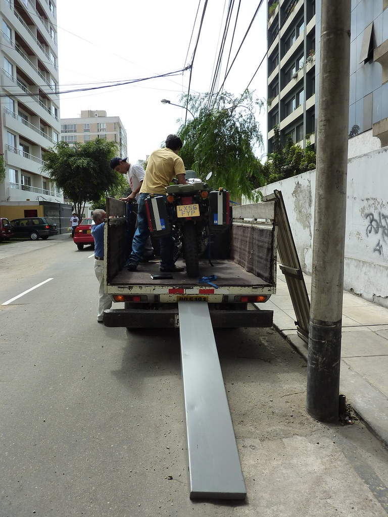
And so, with my own Inca trail complete I´ve now turned my attention to the final country of my trip - Ecuador. To get there I´ve been motoring north on the dull Pan-American Highway. Having gotten as far as Lima, I was expecting to have to ride another 2000km to the equator. But, as is becoming customary in the final stages of these big trips, my bike has run into problems. A slow, but serious oil leak has the Phoenix held up in Peru for a few days. And so, with time running out, I´ve decided to leave her to recuperate for a few days and push on via other means. Ecuador will have to be done on foot.

No matter - I hear it has some of the best trekking in the world.


Here´s to a swift recovery for the Phoenix.

Sunday, April 18, 2010

Breathtaking Bolivia

There´s something oddly rewarding about riding in Bolivia. The difficult roads, thin air, freezing tempartures and lack of water make for a harsh environment. But all that hardship just makes you appreciate the awe inspiring scenery all the more. Crossing Bolivia is difficult, challenging, and exhausting, but I cant think of any other country that offers more in the way of adventure.

Catching up
You´ll remember from my last post that my first attempt at crossing Bolivia ended in a bit of a disaster with the Phoenix and I in rough shape after countless falls in Tupiza Creek. Fortunately though, after a few days of R&R back in Argentina we were both ready for a second go. The Phoenix was riding better than ever thanks to a new clutch, new shock absorber, thorough service, and even a bit of a paint job. And I was feeling rejeunvated following a few days of horse riding and socialising with the locals.


If at first you don´t succeed...
Having left the entertaining civility of Argentina behind, it was time for another crack at Bolivia. My mission was to reach the Salar de Uyuni - the world´s largest and highest salt flats. But rather than ride via Tupiza again, I decided to go for the more scenic and more challenging route via San Pedro de Atacama, Chile.

This is the path that most tourists take in their battle hardened Land Cruisers. It is a spectacular ride lined with volcanoes, sandy plains, mysterious lakes, and salt flats. But, despite the significant tourist presence, the route is one of the roughest Bolivia has to offer, with no discernable roads leading the way, only countless tracks heading in all directions.

I was apprehensive about riding it. There were horror stories of bikers getting bogged on the edge of the salt flats and having to wait days to be rescued. Others of riders getting hopelessly lost and escaping the area with multiple injuries. Even the tour guides with their local knowledge and seemingly bulletproof vehicles had tales of blown suspension, flat tyres, and even the odd broken chassis.

Moreover, to make the going that little bit more difficult, I had to carry extra petrol, food and water as the three hundred mile journey was beyond the range of my tank and through the desolate high altitude Altiplano. With all that extra weight, the bike would handle a little bit worse and be that bit harder to pickup in the event of a spill. And, with my previously detailed GPS maps replaced with nothing more than a blank screen there was every chance of going the wrong way and running into trouble.

But of course, those are exactly the sort of conditions that make for an excellent adventure.

As if to spur me on, even before reaching Bolivia the scenery began getting more and more spectacular. Crossing the Andes via the Pasa de Jama, I was treated to yet more stunning mountain scenery and twisty roads.


And, just on the outskirts of San Pedro was the Valle del Luna - an eerie salty area filled with otherwordly rock formations.


But the real spectacles started cropping up as soon as I crossed into Bolivia.

Premonitions
At the border, I met an American rider - Jebediah from Nebraska - who had just finished the three day odyssey from Uyuni. He was riding with his girl - two up on a Triumph Tiger. That was encouraging. If they could make it through with two people on the same bike, then I shouldn´t have too much to worry about. But as Jebediah regailed me with tales of countless drops, punishingly deep sand, and rocky stretches that had almost broken his suspension, my confidence faded somewhat. According to Jebediah the first leg of the journey to Lago Colorada was the most picturesque and easiest of the trip, while the second day to San Juan was brutally tough. The third was "tricky in places".

His description turned out to be oddly prophetic of my own journey. During the first day I was treated to one stunning sight after another. Barely five miles into Bolivia I was greeted by Lago Verde - a lifeless green lake, laden with arsenic and surrounded by towering volcanoes.


And for the rest of that day, as I made my way to Lago Colorada on decent dirt roads, I was taken aback by the majestic volcanic scenery - truly breathtaking, and not just because I was riding at 5000m above sea level.


Having completed Day 1 with no drops I was feeling good. I found a basic cabana in the small settlement on the edge of the lake and with only a few llamas for company decided to turn in for an early night.


Raring to go the following morning, I dared to dream that I´d make it all the way to the Salar without a single drop.

That was foolish thinking. Within minutes of setting off on the 120 mile journey to San Juan the bike went down in a slow speed drop, courteousy of a deep sandy rutt. Unbeknownst to me, the drop also loosened one of my panniers and I rode for two miles before I realised that the bike´s odd handling was not just because of the rough surface, but because I had lost some luggage. Fortunately, after backtracking I found my case, reattached it, and spent the rest of the day glancing back at my panniers to check they were still there.

The riding wasn´t quite as hard as Jebediah had made out. In fact, at times it was brilliant. There was one particularly special stretch made up of a vast open plain of sandy tracks fringed by volcanoes and martian rock formations.

It was sandy and rocky, but sand is only difficult in a confined space (i.e. in a deep rutt). When there are acres of room to play with you can glide the bike wherever you like. In such a situation there´s only one thing to do - gun the engine and sail smuggly past the tourist jeeps at 60mph.


Of course, my smugness didn´t last for long. After reaching another captivating lake, I basked in the brilliance of the ride for a few minutes, and chatted happily with a few tourists who had pulled up to do the same. Two minutes later, riding over rocky ground, I was down for the second time that day - a completely unexpected slide out caused by a layer of slippery sand on the rocks. Bugger it.


As I spent the obligatory twenty minutes doing post-drop repairs, it was the tourists´turn to smugly ride by. Fair play.

The rest of the day continued in much the same way with the occasional drop (invariably in front of a group of tourists) interspersed with brilliant scenery. By four in the afternoon I had made it to San Juan - exhausted but chuffed to bits. There were five drops that day - three of them big enough to spin the bike around 180 degrees.


But other than a few dents in the Phoenix´s tank, and a few more bruises for me, we had made it through. Based on Jebediah´s description the worst was over. Thank God for that.

Again, I dared to dream that the drops were over, and as a reward I stayed the night in the best hotel in town, had llama for dinner (which was delicious) and spent three hours the following morning treating the Phoenix to a tune up.

As my fellow riders know, whenever I do a bit of work on my bike I have a habit of cutting my hands. Despite wearing gloves, after five weeks on the road and two attempts at crossing Bolivia, this was the state of my mitts.


But I didn´t care that it had taken blood, sweat and a whole lot of effort to get to San Juan. The salt flats were now just a few tantilising miles away and I couldn´t wait to get there. And with the Phoenix riding well, I was adamant I wasn´t going to drop her again (particularly after spending so long getting her cleaned up). But then, after barely an hour´s riding I hit a patch of fesh-fesh - a stretch of seemingly smooth sandy terrain that has the consistency of talcum powder, and usually hides a rocky surface underneath. After fifty feet of erratic bouncing the ground ate my front tyre, snatching the bike sharply to the left, sending me flying over the handlebars and the bike down hard.

I came to an abrupt halt in a dusty ball, with a sprained thumb, bruised shoulder and a mouthful of sand. Stumbling to my feet, I saw that the Phoenix was in similarly bad shape. Both panniers had been ripped off (almost unheard of in a crash), there was another dent in the tank, one of the mirrors was broken, and she too was covered in dust.


Dejected, I spent a few minutes just staring at my bike. I couldn´t believe it. I wasn´t far off kicking sand on it (a la Tyson) but I was saved by a bit of pick-me-up pud (i.e. a chocolate bar). That helped me pull myself together, and I had soon got the bike back upright and was back riding again.

An hour later, we reached the mirrored surface of the salt flats, where I parked up and spent several minutes yelling at the top of my voice and doing a little jig in triumph. We´d finally made it.


And then it was playtime. The salt flats are much like a giant carpark (only much more dazzling and surrounded by volcanoes). And, as all schoolboys know, carparks offer the ideal surface for doing stunts and generally mucking about. That´s exactly how I spent the rest of the day, doing somersaults, tricks, and riding with my eyes closed at 88mph.


An unforgettable place, and an unforgettable journey.